
 Français
 Italiano
Taille de cet aperçu PNG pour ce fichier SVG : 404 × 599 pixels. Autres résolutions : 162 × 240 pixels | 323 × 480 pixels | 518 × 768 pixels | 690 × 1 024 pixels | 1 381 × 2 048 pixels | 1 124 × 1 667 pixels.
Fichier d’origine (Fichier SVG, nominalement de 1 124 × 1 667 pixels, taille : 399 kio)
Description
| Lieu de la prise de vue | | Voir cet endroit et d’autres images sur : OpenStreetMap |
|---|
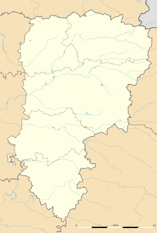
| Description | English: Blank administrative map of the department of Aisne, France, as in January 2015, for geo-location purpose, with distinct boundaries for regions, departments and arrondissements. Français : Carte administrative vierge du département de l'Aisne, France, tel qu'en janvier 2015, destinée à la géolocalisation, avec limite distincte des régions, départements et arrondissements. Estimated scale: 1:360,000 (precision: 90 m)
Geographic limits of the map:
| ||
| Date | |||
| Source | Travail personnel
| ||
| Auteur | Eric Gaba (Sting - fr:Sting) | ||
| Autorisation (Réutilisation de ce fichier) |
| ||
| Autres versions |
|

Conditions d’utilisation
Eric Gaba, Wikimedia Commons user Sting, en tant que détenteur des droits d’auteur sur cette œuvre, la publie sous la licence suivante :
Ce fichier est disponible selon les termes de la licence Creative Commons Attribution – Partage dans les Mêmes Conditions 3.0 Non Transposé.
Attribution: Eric Gaba, Wikimedia Commons user Sting
- Vous êtes libre :
- de partager – de copier, distribuer et transmettre cette œuvre
- d’adapter – de modifier cette œuvre
- Sous les conditions suivantes :
- paternité – Vous devez donner les informations appropriées concernant l'auteur, fournir un lien vers la licence et indiquer si des modifications ont été faites. Vous pouvez faire cela par tout moyen raisonnable, mais en aucune façon suggérant que l’auteur vous soutient ou approuve l’utilisation que vous en faites.
- partage à l’identique – Si vous modifiez, transformez ou vous basez sur cet élément, vous devez distribuer votre contribution sous une license identique ou compatible à celle de l’original.
Historique du fichier
Cliquer sur une date et heure pour voir le fichier tel qu'il était à ce moment-là.
| Date et heure | Vignette | Dimensions | Utilisateur | Commentaire | |
|---|---|---|---|---|---|
| actuel | 12 janvier 2015 à 17:05 | | 1 124 × 1 667 (399 kio) | Sting | == {{int:filedesc}} == {{Location|49|27|00|N|03|36|00|E|scale:500000}} {{Information |Description={{en|Blank administrative map of the department of Aisne, France, as in January 2015, for geo-location purpose, with distinct boundaries for... |
Utilisation du fichier
Aucune page n’utilise ce fichier.
Usage global du fichier
Les autres wikis suivants utilisent ce fichier :
- Utilisation sur als.wikipedia.org
- Utilisation sur de.wikipedia.org
- Utilisation sur en.wikipedia.org
- Utilisation sur eo.wikipedia.org
- Vermand
- Château-Thierry
- Laon
- Saint-Quentin (Aisne)
- Soissons
- Vervins
- Beaurevoir
- Marly-Gomont
- Chézy-sur-Marne
- La Ferté-Milon
- Nogent-l'Artaud
- Charly-sur-Marne
- Bazoches-sur-Vesles
- Tergnier
- Ŝablono:Situo sur mapo Francio Aisne
- Saint-Quentin (stacidomo)
- Quierzy
- Laon (stacidomo)
- Soissons (stacidomo)
- Hirson (stacidomo)
- Hirson
- Vervins (stacidomo)
- Villers-Cotterêts (stacidomo)
- Longpont (stacidomo)
- Longpont
- Hirson-Écoles (stacidomo)
- Vierzy (stacidomo)
- Vierzy
- Versigny (stacidomo)
- Versigny (Aisne)
- Vaumoise (stacidomo)
- Coyolles
- Vauxaillon (stacidomo)
- Vauxaillon
- Verneuil-sur-Serre (stacidomo)
- Verneuil-sur-Serre
- Viry-Noureuil (stacidomo)
- Viry-Noureuil
- Fère-en-Tardenois (stacidomo)
- Fère-en-Tardenois
- Dercy - Mortiers (stacidomo)
Voir davantage sur l’utilisation globale de ce fichier.
Métadonnées
Explore the world

United states
New York

Japan
Tokyo

Singapore
Singapore
