
 Français
 Italiano
Taille de cet aperçu PNG pour ce fichier SVG : 521 × 599 pixels. Autres résolutions : 209 × 240 pixels | 417 × 480 pixels | 667 × 768 pixels | 890 × 1 024 pixels | 1 780 × 2 048 pixels | 864 × 994 pixels.
Fichier d’origine (Fichier SVG, nominalement de 864 × 994 pixels, taille : 135 kio)
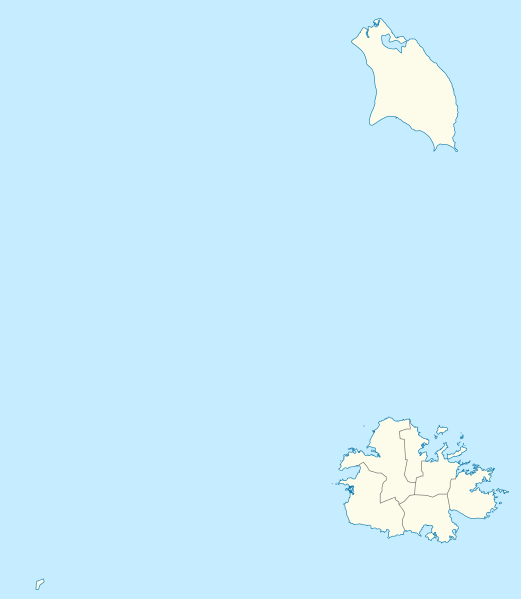
| Description | Deutsch: Positionskarte von Antigua und Barbuda. Geographische Begrenzungen der Karte:
English: Location map of Antigua and Barbuda. Geographic limits of the map:
|
| Date | |
| Source | Travail personnel avec: OpenStreetMap data for the coastlines |
| Auteur | Graphic made by Carport |
| Autres versions | _location_map.svg) |
| SVG information | Cette carte a été créée avec Adobe Illustrator |
Conditions d’utilisation
Ce fichier est disponible selon les termes de la licence Creative Commons Attribution – Partage dans les Mêmes Conditions 2.0 Générique
- Vous êtes libre :
- de partager – de copier, distribuer et transmettre cette œuvre
- d’adapter – de modifier cette œuvre
- Sous les conditions suivantes :
- paternité – Vous devez donner les informations appropriées concernant l'auteur, fournir un lien vers la licence et indiquer si des modifications ont été faites. Vous pouvez faire cela par tout moyen raisonnable, mais en aucune façon suggérant que l’auteur vous soutient ou approuve l’utilisation que vous en faites.
- partage à l’identique – Si vous modifiez, transformez ou vous basez sur cet élément, vous devez distribuer votre contribution sous une license identique ou compatible à celle de l’original.
Historique du fichier
Cliquer sur une date et heure pour voir le fichier tel qu'il était à ce moment-là.
| Date et heure | Vignette | Dimensions | Utilisateur | Commentaire | |
|---|---|---|---|---|---|
| actuel | 21 octobre 2013 à 17:25 | | 864 × 994 (135 kio) | TUBS | +subdivisions |
| 23 novembre 2009 à 19:58 |  | 1 080 × 1 243 (182 kio) | Carport | {{Information |Description={{de|1=Positionskarte von {{w|Antigua und Barbuda|3=de}}. Geographische Begrenzungen der Karte: * N: 17.755° N * S: 16.919° N * W: 62.4° W * E: 61.639° W}} {{en|1=Location map of {{w|Antigua and Barbuda}}. Geographic limits |
Utilisation du fichier
Aucune page n’utilise ce fichier.
Usage global du fichier
Les autres wikis suivants utilisent ce fichier :
- Utilisation sur af.wikipedia.org
- Utilisation sur an.wikipedia.org
- Utilisation sur ar.wikipedia.org
- Utilisation sur ast.wikipedia.org
- Utilisation sur ay.wikipedia.org
- Utilisation sur az.wikipedia.org
- Utilisation sur be.wikipedia.org
- Utilisation sur bg.wikipedia.org
- Utilisation sur bn.wikipedia.org
- Utilisation sur bs.wikipedia.org
- Utilisation sur ceb.wikipedia.org
- Plantilya:Location map Antigua and Barbuda
- York Island (pulo sa Antigwa ug Barbuda, Parish of Saint Philip)
- Willoughby Bay (luuk sa Antigwa ug Barbuda)
- William Point (punta sa Antigwa ug Barbuda)
- White Cliff (pangpang sa Antigwa ug Barbuda)
- West Channel (agianan sa Antigwa ug Barbuda)
- Welch Point (punta sa Antigwa ug Barbuda)
- Tucks Point (punta)
- Mount Thomas (bukid sa Antigwa ug Barbuda)
- Table Hill (bungtod sa Antigwa ug Barbuda)
- Sugar Loaf Hill (bungtod sa Antigwa ug Barbuda)
- Spanish Point (punta sa Antigwa ug Barbuda)
- South Point (punta sa Antigwa ug Barbuda)
- South Channel (agianan nga kadagatan sa Antigwa ug Barbuda)
- Soldier Point (punta sa Antigwa ug Barbuda, Parish of Saint John)
- Soldier Point (punta sa Antigwa ug Barbuda, Parish of Saint Philip)
- Soldier Bay (luuk sa Antigwa ug Barbuda)
- Snapper Point (punta sa Antigwa ug Barbuda)
- Smith Island (pulo sa Antigwa ug Barbuda)
- Smith Hill (bungtod sa Antigwa ug Barbuda)
- The Sisters (pulo sa Antigwa ug Barbuda)
- Signal Hill (bukid sa Antigwa ug Barbuda)
- Shoal Point (punta sa Antigwa ug Barbuda)
- Scotts Hill (bungtod sa Antigwa ug Barbuda)
- Sandy Island Channel (agianan sa Antigwa ug Barbuda)
- Sandy Island (pulo sa Antigwa ug Barbuda)
- Parish of Saint Peter (parokya sa Antigwa ug Barbuda)
Voir davantage sur l’utilisation globale de ce fichier.
Métadonnées
Explore the world

United states
New York

Japan
Tokyo

Singapore
Singapore
