
 Français
 Italiano
Taille de cet aperçu : 555 × 599 pixels. Autres résolutions : 222 × 240 pixels | 445 × 480 pixels | 711 × 768 pixels | 949 × 1 024 pixels | 2 000 × 2 159 pixels.
Fichier d’origine (2 000 × 2 159 pixels, taille du fichier : 967 kio, type MIME : image/jpeg)
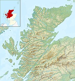
| Description | Relief map of Highland, UK. Equirectangular map projection on WGS 84 datum, with N/S stretched 180% Geographic limits:
|
| Date | |
| Source |
|
| Auteur | Nilfanion, created using Ordnance Survey data |
| Autorisation (Réutilisation de ce fichier) | Ce fichier est disponible selon les termes de la licence Creative Commons Attribution – Partage dans les Mêmes Conditions 3.0 Non Transposé. Attribution: Contains Ordnance Survey data © Crown copyright and database right
|
| Autres versions | File:Highland UK blank map.svg - Blank map |
Historique du fichier
Cliquer sur une date et heure pour voir le fichier tel qu'il était à ce moment-là.
| Date et heure | Vignette | Dimensions | Utilisateur | Commentaire | |
|---|---|---|---|---|---|
| actuel | 30 novembre 2011 à 12:22 | | 2 000 × 2 159 (967 kio) | Nilfanion | {{Information |Description=Relief map of Highland, UK. Equirectangular map projection on WGS 84 datum, with N/S stretched 180% Geographic limits: *West: 6.9W *East: 2.9W *North: 58.8N *South: 56.4N |Source=[[w:Ordnance Surv |
Utilisation du fichier
Aucune page n’utilise ce fichier.
Usage global du fichier
Les autres wikis suivants utilisent ce fichier :
- Utilisation sur ar.wikipedia.org
- Utilisation sur arz.wikipedia.org
- Utilisation sur ba.wikipedia.org
- Utilisation sur bg.wikipedia.org
- Utilisation sur ceb.wikipedia.org
- Utilisation sur de.wikipedia.org
- Innere Hebriden
- Loch Ness
- Ben Nevis
- Eilean Donan Castle
- Urquhart Castle
- Canna
- Loch Morar
- Loch Linnhe
- Ardnamurchan
- Loch Oich
- Loch Shin
- Girnigoe and Sinclair Castle
- Dunvegan Castle
- Eilean Horrisdale
- Camus nan Geall
- Glen Coe
- Loch Lochy
- Loch Arkaig
- Loch Maree
- Ballone Castle
- Soay (Innere Hebriden)
- Ascrib Islands
- Eilean Trodday
- Wiay
- Loch Shiel
- Bealach na Bà
- Loch Assynt
- Loch Affric
- Loch Beinn a’ Mheadhoin
- Loch Cluanie
- Loch Coruisk
- Loch Dochfour
- Loch Dùghaill
- Loch an Eilean
- Loch Einich
- Loch Ericht
- Loch Loyal
- Càrn Eighe
- Cairn Gorm
- Glen Affric
- Brochel Castle
Voir davantage sur l’utilisation globale de ce fichier.
Explore the world

United states
New York

Japan
Tokyo

Singapore
Singapore
