
 Français
 Italiano
Description
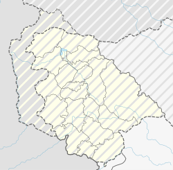
| Description | Deutsch: Positionskarte des Unionsterritoriums Jammu und Kashmir, Indien English: Location map of the Union Territory of Jammu and Kashmir, India
| ||||||||||||
| Date | |||||||||||||
| Source | Travail personnel avec:
| ||||||||||||
| Auteur | NordNordWest | ||||||||||||
 | Cette carte a été créée ou améliorée dans le Kartenwerkstatt (Atelier cartographique allemand). Vous pouvez également y proposer des cartes à améliorer. |
Conditions d’utilisation
Usage de cette carte :

Pour un usage gratuit, je recommande de respecter les conditions suivantes de la licence :
1. Inclure mon nom comme indiqué ci-dessus : NordNordWest,
2. une copie ou l'adresse Internet (Identifiant Uniforme de Ressource) du contrat : https://creativecommons.org/licenses/by-sa/3.0/de/legalcode,
3. le titre de l’œuvre originale,
4. dans le cas d'une œuvre dérivée, indiquer les éléments identifiant l'utilisation de l’œuvre dite dérivée.
En cas de manquement aux conditions de la licence, les droits d'utilisation expirent automatiquement. Si vous avez des questions ou désirez des conditions différentes, merci de me contacter par courriel à l'adresse nnwest, ou sur ma page de discussion. ![]() t-online.de
t-online.de
- Vous êtes libre :
- de partager – de copier, distribuer et transmettre cette œuvre
- d’adapter – de modifier cette œuvre
- Sous les conditions suivantes :
- paternité – Vous devez donner les informations appropriées concernant l'auteur, fournir un lien vers la licence et indiquer si des modifications ont été faites. Vous pouvez faire cela par tout moyen raisonnable, mais en aucune façon suggérant que l’auteur vous soutient ou approuve l’utilisation que vous en faites.
- partage à l’identique – Si vous modifiez, transformez ou vous basez sur cet élément, vous devez distribuer votre contribution sous une license identique ou compatible à celle de l’original.

Historique du fichier
Cliquer sur une date et heure pour voir le fichier tel qu'il était à ce moment-là.
| Date et heure | Vignette | Dimensions | Utilisateur | Commentaire | |
|---|---|---|---|---|---|
| actuel | 22 juillet 2022 à 05:59 | | 808 × 791 (101 kio) | NordNordWest | Reverted to version as of 12:26, 21 July 2022 (UTC), please see COM:OVERWRITE |
| 22 juillet 2022 à 05:53 |  | 757 × 741 (201 kio) | Crashed greek | Reverted to version as of 08:33, 21 July 2022 (UTC) | |
| 21 juillet 2022 à 12:26 |  | 808 × 791 (101 kio) | NordNordWest | Reverted to version as of 18:46, 11 July 2022 (UTC), still disputed between India and Pakistan | |
| 21 juillet 2022 à 08:33 |  | 757 × 741 (201 kio) | Crashed greek | Reverted to version as of 15:12, 11 July 2022 (UTC) Line of Control is recognised by UN | |
| 11 juillet 2022 à 18:46 |  | 808 × 791 (101 kio) | NordNordWest | upd | |
| 11 juillet 2022 à 16:35 |  | 808 × 791 (79 kio) | NordNordWest | Reverted to version as of 16:18, 5 November 2020 (UTC) J&K is disputed | |
| 11 juillet 2022 à 15:12 |  | 757 × 741 (201 kio) | C1MM | Corrected positions of rivers and disticts. This map shows the de-facto situation, where India does not control Azad Kashmir or Gilgit-Baltistan and controls J&K and Ladakh. | |
| 5 novembre 2020 à 16:18 |  | 808 × 791 (79 kio) | NordNordWest | corr | |
| 11 novembre 2019 à 16:48 |  | 808 × 791 (84 kio) | NordNordWest | corr | |
| 10 septembre 2019 à 18:00 |  | 1 191 × 1 276 (162 kio) | NordNordWest | == {{int:filedesc}} == {{Information |Description= {{de|1=Positionskarte des Unionsterritoriums Jammu und Kashmir, Indien}} {{en|1=Location map of the Union Territory of Jammu and Kashmir, India}} {{Location map series N |stretching=120 |top=37.2 |bottom=32.2 |left=72.4 |right=78.0 }} |Source={{Own using}} * United States National Imagery and Mapping Agency data * World Data Base II data |Date=2019-09-10 |Author={{U|NordNordWest}} |Permission= |other_versions= }} {{Kartenwerkstatt}} == {{int... |
Utilisation du fichier
Aucune page n’utilise ce fichier.
Usage global du fichier
Les autres wikis suivants utilisent ce fichier :
- Utilisation sur bh.wikipedia.org
- Utilisation sur de.wikipedia.org
- Utilisation sur en.wikipedia.org
- Utilisation sur fr.wikipedia.org
- Srinagar
- Jardins de Shalimar (Cachemire)
- Modèle:Géolocalisation/Jammu-et-Cachemire
- Barrage de Baglihar
- Poonch
- Kathua
- Samba (Jammu-et-Cachemire)
- Kishtwar
- Badgam
- Ramban (Jammu-et-Cachemire)
- Ganderbal
- Bandipora
- Udhampur
- Anantnag
- Reasi
- Kulgam
- Rajauri
- Doda (Jammu-et-Cachemire)
- Kupwara
- Baramulla
- Shupiyan
- Pulwama
- Gulmarg
- Attentat de Pulwama
- Modèle:Géolocdual/Jammu-et-Cachemire
- Aéroport de Jammu
- Aéroport de Srinagar
- Utilisation sur lv.wikipedia.org
- Utilisation sur ta.wikipedia.org
- Utilisation sur uk.wikipedia.org
Métadonnées
Explore the world

United states
New York

Japan
Tokyo

Singapore
Singapore
