
 Français
 Italiano
Taille de cet aperçu : 602 × 600 pixels. Autres résolutions : 241 × 240 pixels | 482 × 480 pixels | 771 × 768 pixels | 1 027 × 1 024 pixels | 1 482 × 1 477 pixels.
Fichier d’origine (1 482 × 1 477 pixels, taille du fichier : 1,02 Mio, type MIME : image/jpeg)
Description
| Lieu de la prise de vue | | Voir cet endroit et d’autres images sur : OpenStreetMap |
|---|
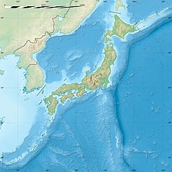
| Description | English: Blank relief location map of Japan. Note: some remote Southern and Eastern islands, out of the map, are not represented. Français : Carte physique vierge du Japon destinée à la géolocalisation.
| ||
| Date | |||
| Source | Travail personnel
| ||
| Auteur | Eric Gaba (Sting - fr:Sting) | ||
| Autorisation (Réutilisation de ce fichier) |
| ||
| Autres versions |
|


Conditions d’utilisation
Eric Gaba (Wikimedia Commons user Sting), en tant que détenteur des droits d’auteur sur cette œuvre, la publie sous la licence suivante :
Ce fichier est sous licence Creative Commons Attribution - Partage Dans Les Mêmes Conditions 4.0 International, 3.0 Non Transposé, 2.5 Générique, 2.0 Générique et 1.0 Générique.
Attribution: Eric Gaba (Wikimedia Commons user Sting)
- Vous êtes libre :
- de partager – de copier, distribuer et transmettre cette œuvre
- d’adapter – de modifier cette œuvre
- Sous les conditions suivantes :
- paternité – Vous devez donner les informations appropriées concernant l'auteur, fournir un lien vers la licence et indiquer si des modifications ont été faites. Vous pouvez faire cela par tout moyen raisonnable, mais en aucune façon suggérant que l’auteur vous soutient ou approuve l’utilisation que vous en faites.
- partage à l’identique – Si vous modifiez, transformez ou vous basez sur cet élément, vous devez distribuer votre contribution sous une license identique ou compatible à celle de l’original.
Historique du fichier
Cliquer sur une date et heure pour voir le fichier tel qu'il était à ce moment-là.
| Date et heure | Vignette | Dimensions | Utilisateur | Commentaire | |
|---|---|---|---|---|---|
| actuel | 9 mars 2022 à 21:20 | | 1 482 × 1 477 (1,02 Mio) | Sting | == {{int:filedesc}} == {{Location|35|15|18|N|136|46|12|E|scale:10000000}} {{Information |description={{en|Blank relief location map of {{W|Japan}}.<br/> ''Note: some remote Southern and Eastern islands, out of the map, are not represented.''}} {{fr|Carte physique vierge du {{Wf|Japon}} destinée à la géolocalisation.}} *Equirectangular projection; WGS84 datum *Scale: 1:7,256,000 (precision: 1,814 m) *Center of the map: 35°15'18" N - 136°46'12" E (35.255° N - 136.77° E) *Geographic limits of th... |
Utilisation du fichier
Aucune page n’utilise ce fichier.
Usage global du fichier
Les autres wikis suivants utilisent ce fichier :
- Utilisation sur cs.wikipedia.org
- Utilisation sur de.wikipedia.org
- Utilisation sur fr.wikipedia.org
- Dejima
- Hokkaidō
- Honshū
- Shikoku
- Yonaguni-jima
- Bataille d'Iwo Jima
- Bataille d'Okinawa
- Iwo Jima
- Îles Ryūkyū
- Archipel d'Izu
- Ha-shima
- Yaku-shima
- Îles Yaeyama
- Mer intérieure de Seto
- Kyūshū
- Awaji-shima
- Miyake-jima
- Ishigaki-jima
- Île Okinawa
- Iriomote-jima
- Lac Towada
- Bataille de Nagashino
- Siège de Nara
- Lac Biwa
- Tanega-shima
- Séisme de 1891 à Nōbi
- Îles Amakusa
- Jeux paralympiques d'été de 1964
- Archipel Nanpō
- Îles Gotō
- Izu ō-shima
Voir davantage sur l’utilisation globale de ce fichier.
Métadonnées
Explore the world

United states
New York

Japan
Tokyo

Singapore
Singapore
