
 Français
 Italiano
Fichier d’origine (Fichier SVG, nominalement de 2 343 × 2 626 pixels, taille : 1,6 Mio)
_-_OSM_Mapnik.svg)
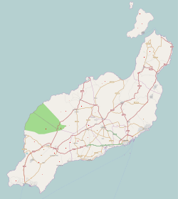
| Description | Cette carte a été créée à partir des données du projet OpenStreetMap. Cette carte est peut-être incomplète et peut contenir des erreurs. Ne vous fiez pas uniquement à elle pour vos déplacements. | |||
| Date | (voir l'historique du fichier) | |||
| Source | http://www.openstreetmap.org/?lat=29.066&lon=-13.633&zoom=10&layers=B000FTFTT | |||
| Créé par | contributeurs d'OpenStreetMap | |||
| Autorisation (Réutilisation de ce fichier) | Les données d'OpenStreetMap sont disponibles sous la license Open Database (détails). Les cartes sont publiées sous license Creative Commons Attribution-Partage dans les Mêmes Conditions 2.0 (CC-BY-SA 2.0).
Ce fichier est disponible selon les termes de la licence Creative Commons Attribution – Partage dans les Mêmes Conditions 2.0 Générique
| |||
| Géoréférencement | Si c'est inapproprié, définissez warp_status = skip pour masquer. |
Historique du fichier
Cliquer sur une date et heure pour voir le fichier tel qu'il était à ce moment-là.
| Date et heure | Vignette | Dimensions | Utilisateur | Commentaire | |
|---|---|---|---|---|---|
| actuel | 25 novembre 2010 à 13:48 | | 2 343 × 2 626 (1,6 Mio) | Muro de Aguas | updating |
| 2 juillet 2010 à 14:24 |  | 2 343 × 2 626 (1,41 Mio) | Muro de Aguas | updating | |
| 16 avril 2010 à 17:22 |  | 2 343 × 2 626 (1,4 Mio) | Muro de Aguas | updating | |
| 27 février 2010 à 17:21 |  | 2 343 × 2 626 (1,34 Mio) | Muro de Aguas | {{OpenStreetMap|name=Lanzarote|source=http://www.openstreetmap.org/?lat=29.066&lon=-13.633&zoom=10&layers=B000FTFTT}} Category:OpenStreetMap maps of the Canary Islands Category:Maps of Lanzarote Category:Maps of the Canary Islands |
Utilisation du fichier
Aucune page n’utilise ce fichier.
Usage global du fichier
Les autres wikis suivants utilisent ce fichier :
- Utilisation sur ar.wikipedia.org
- Utilisation sur ast.wikipedia.org
- Utilisation sur da.wikipedia.org
- Utilisation sur en.wikipedia.org
- Lanzarote
- Arrecife
- Puerto del Carmen
- Lanzarote Airport
- Graciosa, Canary Islands
- Montaña Clara
- Teguise (municipality)
- Teguise (village)
- Guatiza
- Timanfaya National Park
- Costa Teguise
- Órzola
- Caleta de Sebo
- Arrieta, Lanzarote
- Playa Blanca
- Casas de Pedro Barba
- Charco del Palo
- Tahíche
- Module:Location map/data/Spain Lanzarote
- Castillo de San José
- Module:Location map/data/Spain Lanzarote/doc
- Template:Lighthouses of the Canary Islands map
- Famara
- Strait of El Río
- User:Shazertom/La Graciosa
- Utilisation sur eo.wikipedia.org
- Utilisation sur es.wikipedia.org
Voir davantage sur l’utilisation globale de ce fichier.
_-_OSM_Mapnik.svg)
_-_OSM_Mapnik.svg)
Explore the world

United states
New York

Japan
Tokyo

Singapore
Singapore
