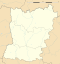
Taille de cet aperçu : 562 × 599 pixels. Autres résolutions : 225 × 240 pixels | 450 × 480 pixels | 720 × 768 pixels | 1 036 × 1 105 pixels.
Fichier d’origine (1 036 × 1 105 pixels, taille du fichier : 232 kio, type MIME : image/jpeg)
Historique du fichier
Cliquer sur une date et heure pour voir le fichier tel qu'il était à ce moment-là.
| Date et heure | Vignette | Dimensions | Utilisateur | Commentaire | |
|---|---|---|---|---|---|
| actuel | 12 mars 2011 à 14:48 |  | 1 036 × 1 105 (232 kio) | Sting | == {{int:filedesc}} == {{Information |Description={{en|Blank physical map of the department of Mayenne, France, as in February 2011, for geo-location purpose, with distinct boundaries for regions, departments and arrondissements.}} {{fr|Ca |
Utilisation du fichier
Aucune page n’utilise ce fichier.
Usage global du fichier
Les autres wikis suivants utilisent ce fichier :
- Utilisation sur als.wikipedia.org
- Utilisation sur de.wikipedia.org
- Utilisation sur eo.wikipedia.org
- Utilisation sur fr.wikipedia.org
- Mayenne (département)
- Laval (Mayenne)
- Saint-Ouën-des-Toits
- Mayenne (commune)
- Château-Gontier
- Bonchamp-lès-Laval
- Saint-Pierre-sur-Orthe
- Andouillé
- Fougerolles-du-Plessis
- Izé
- Craon (Mayenne)
- Bazougers
- Châlons-du-Maine
- La Bazoge-Montpinçon
- Saint-Berthevin (Mayenne)
- Olivet (Mayenne)
- Saint-Julien-du-Terroux
- Cuillé
- Grez-en-Bouère
- Saint-Pierre-des-Nids
- La Chapelle-Anthenaise
- Montourtier
- Madré
- Saint-Sulpice (Mayenne)
- Saint-Hilaire-du-Maine
- Saint-Ellier-du-Maine
- Chemazé
- Le Bourgneuf-la-Forêt
- Renazé
- Saulges
- Azé (Mayenne)
- Jublains
- Évron
- Gorron
- Ernée
- Bouère
- Saint-Denis-de-Gastines
- La Cropte
- Châtillon-sur-Colmont
- Forêt de Concise
- Averton
- Chémeré-le-Roi
Voir davantage sur l’utilisation globale de ce fichier.


 Français
 Italiano


