
 Français
 Italiano
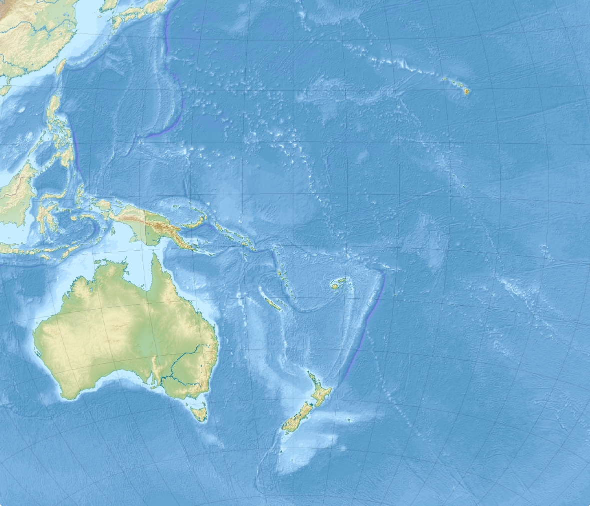
Taille de cet aperçu : 699 × 600 pixels. Autres résolutions : 280 × 240 pixels | 560 × 480 pixels | 895 × 768 pixels | 1 181 × 1 013 pixels.
Fichier d’origine (1 181 × 1 013 pixels, taille du fichier : 1 022 kio, type MIME : image/jpeg)
Description
| Description | English: Relief location map of Oceania.
|
| Date | |
| Source | Travail personnel |
| Auteur | Uwe Dedering |
Conditions d’utilisation
Moi, en tant que détenteur des droits d’auteur sur cette œuvre, je la publie sous les licences suivantes :
Ce fichier est disponible selon les termes de la licence Creative Commons Attribution – Partage dans les Mêmes Conditions 3.0 Non Transposé.
- Vous êtes libre :
- de partager – de copier, distribuer et transmettre cette œuvre
- d’adapter – de modifier cette œuvre
- Sous les conditions suivantes :
- paternité – Vous devez donner les informations appropriées concernant l'auteur, fournir un lien vers la licence et indiquer si des modifications ont été faites. Vous pouvez faire cela par tout moyen raisonnable, mais en aucune façon suggérant que l’auteur vous soutient ou approuve l’utilisation que vous en faites.
- partage à l’identique – Si vous modifiez, transformez ou vous basez sur cet élément, vous devez distribuer votre contribution sous une license identique ou compatible à celle de l’original.
 | Vous avez la permission de copier, distribuer et modifier ce document selon les termes de la GNU Free Documentation License version 1.2 ou toute version ultérieure publiée par la Free Software Foundation, sans sections inaltérables, sans texte de première page de couverture et sans texte de dernière page de couverture. Un exemplaire de la licence est inclus dans la section intitulée GNU Free Documentation License. |
Vous pouvez choisir l’une de ces licences.
Historique du fichier
Cliquer sur une date et heure pour voir le fichier tel qu'il était à ce moment-là.
| Date et heure | Vignette | Dimensions | Utilisateur | Commentaire | |
|---|---|---|---|---|---|
| actuel | 28 novembre 2010 à 14:03 | | 1 181 × 1 013 (1 022 kio) | Uwe Dedering | {{Information |Description={{en|1= Relief location map of Oceania. * Projection: Lambert azimuthal equal-area projection. * Area of interest: :* N: 35.0° N :* S: -55.0° N :* W: 110.0° E :* E: 230.0° E (This is -130° E) * Projection center: :* NS: -10 |
Utilisation du fichier
Aucune page n’utilise ce fichier.
Usage global du fichier
Les autres wikis suivants utilisent ce fichier :
- Utilisation sur ar.wikipedia.org
- Utilisation sur ast.wikipedia.org
- Utilisation sur az.wikipedia.org
- Utilisation sur ban.wikipedia.org
- Utilisation sur ba.wikipedia.org
- Utilisation sur be.wikipedia.org
- Шаблон:На карце/Акіянія
- Лорд-Хау
- Науру (востраў)
- Астравы Таварыства
- Тарава (атол)
- Праліў Торэса
- Банаба
- Рабі (востраў)
- Уоліс
- Увеа (востраў, Уоліс і Футуна)
- Хорн
- Футуна (востраў, Уоліс і Футуна)
- Алофі (востраў)
- Луаятэ
- Чэстэрфілд (астравы)
- Мак-Кін
- Равакі
- Нікумарора
- Арона (атол)
- Мінаміторы
- Касрае (востраў)
- Utilisation sur bg.wikipedia.org
Voir davantage sur l’utilisation globale de ce fichier.
Métadonnées
Explore the world

United states
New York

Japan
Tokyo

Singapore
Singapore
