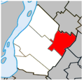
Saint-Bruno-de-Montarville_Quebec_location_diagram.PNG (329 × 315 pixels, taille du fichier : 45 kio, type MIME : image/png)
Historique du fichier
Cliquer sur une date et heure pour voir le fichier tel qu'il était à ce moment-là.
| Date et heure | Vignette | Dimensions | Utilisateur | Commentaire | |
|---|---|---|---|---|---|
| actuel | 4 juillet 2023 à 17:02 |  | 329 × 315 (45 kio) | Roncanada | Correction to Longueuil's border |
| 27 avril 2009 à 01:12 |  | 325 × 315 (37 kio) | Gordalmighty | map outline correction | |
| 25 avril 2009 à 02:16 |  | 325 × 315 (38 kio) | Gordalmighty | size problem Category:Saint-Bruno-de-Montarville | |
| 25 avril 2009 à 02:02 |  | 325 × 415 (20 kio) | Gordalmighty | {{Information |Description={{en|1=Location of Saint-Bruno-de-Montarville, Quebec within the Urban Agglomeration of Longueuil.}} |Source=Own work by uploader |Author=Gordalmighty |Date=2009-04-24 |Permission= |other_versions= }} <!-- |
Utilisation du fichier
Aucune page n’utilise ce fichier.
Usage global du fichier
Les autres wikis suivants utilisent ce fichier :
- Utilisation sur ar.wikipedia.org
- Utilisation sur de.wikipedia.org
- Utilisation sur en.wikipedia.org
- Utilisation sur eo.wikipedia.org
- Utilisation sur es.wikipedia.org
- Utilisation sur fr.wikipedia.org
- Utilisation sur hak.wikipedia.org
- Utilisation sur ko.wikipedia.org
- Utilisation sur ur.wikipedia.org
- Utilisation sur www.wikidata.org


 Français
 Italiano


