
 Français
 Italiano
Description
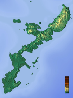
| Description | English: Topographic map of Okinawa Island. 日本語: 沖縄島の地形図 |
| Date | |
| Source | http://www.maps-for-free.com/ |
| Auteur | Retouched by Kugel~commonswiki |
| Autorisation (Réutilisation de ce fichier) | http://www.maps-for-free.com/html/about.html |
| Autres versions |
|


Conditions d’utilisation
Cette copie d'écran soit ne contient pas de parties ou de visuels de programmes sous copyright, soit l'auteur l'a placée sous une licence libre (indiquée sous cette notice), et suit donc les règles de Commons. Vous pouvez l'utiliser librement d'après sa licence particulière. Licence de Logiciel Libre :
 | Cette œuvre est un logiciel libre ; vous pouvez la redistribuer ou la modifier suivant les termes de la Licence publique générale GNU telle que publiée par la Free Software Foundation, soit la version 2 de cette License, soit une version ultérieure. Cette œuvre est distribuée dans l’espoir qu’elle sera utile, mais sans aucune garantie, pas même la garantie implicite de commercialisabilité ni celle d’adéquation à un besoin particulier. Consultez la version 2 et la version 3 de la GNU General Public License pour plus de détails. |
Note : si la copie d'écran montre n'importe quel travail qui n'est pas directement le résultat du code du programme lui-même, comme des textes ou des images qui ne font pas partie du logiciel, la licence de ce travail doit être indiquée séparément.
| Ce fichier est dans le domaine public selon les termes de la licence Creative Commons CC0 1.0 Universel. | |
| La personne qui a associé une œuvre avec cet acte l’a placée dans le domaine public en renonçant mondialement à tous ses droits sur cette œuvre en vertu des lois relatives au droit d’auteur, ainsi qu’à tous les droits juridiques connexes et voisins qu’elle possédait sur l’œuvre, sans autre limite que celles imposées par la loi. Vous pouvez copier, modifier, distribuer et utiliser cette œuvre, y compris à des fins commerciales, sans qu’il soit nécessaire d’en demander la permission.
|
Historique du fichier
Cliquer sur une date et heure pour voir le fichier tel qu'il était à ce moment-là.
| Date et heure | Vignette | Dimensions | Utilisateur | Commentaire | |
|---|---|---|---|---|---|
| actuel | 17 octobre 2021 à 02:37 | | 750 × 1 000 (552 kio) | Kugel~commonswiki | == {{int:filedesc}} == {{Information |Description ={{en|1=Topographic map of Okinawa Island.}} {{ja|1=沖縄島の地形図}} |Source =http://www.maps-for-free.com/ |Author =Retouched by Kugel~commonswiki |Date =2021-10-17 |Permission =http://www.maps-for-free.com/html/about.html |other_versions =<gallery> File:Topographic map of Okinawa Island.png|Original file File:Map of Okinawa Island 02.svg|SVG version </gallery> }} == {{int:license-header}}... |
Utilisation du fichier
Aucune page n’utilise ce fichier.
Usage global du fichier
Les autres wikis suivants utilisent ce fichier :
- Utilisation sur fa.wikipedia.org
- Utilisation sur fr.wikipedia.org
- Utilisation sur ja.wikipedia.org
- 伊江島
- 水納島 (沖縄県本部町)
- 久高島
- 仲原遺跡
- 屋我地島
- 津堅島
- 瀬底島
- 与那覇岳
- 古宇利島
- 宇佐浜遺跡
- 伊計島
- 平安座島
- 宮城島 (沖縄県うるま市)
- 牧港火力発電所
- 瀬長島
- 浜比嘉島
- 藪地島
- 宮城島 (沖縄県大宜味村)
- 奥武島 (沖縄県名護市)
- 奥武島 (沖縄県南城市)
- 石川火力発電所
- 吉の浦火力発電所
- 八重岳
- 安田ヶ島
- 浮原島
- モジュール:Location map/data/沖縄本島
- モジュール:Location map/data/沖縄本島/doc
- サキタリ洞遺跡
- 港川遺跡
- エージナ島
- ガンガラーの谷
- 嘉津宇岳
- 安和岳
- 伊湯岳
- 恩納岳
- 辺戸岳
- 与座岳
- 八重瀬岳
- 伊保島
- 沖之島 (沖縄県)
- 石川岳
- 名護岳
Voir davantage sur l’utilisation globale de ce fichier.
Métadonnées
Explore the world

United states
New York

Japan
Tokyo

Singapore
Singapore
