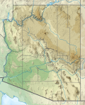
Taille de cet aperçu PNG pour ce fichier SVG : 487 × 599 pixels. Autres résolutions : 195 × 240 pixels | 390 × 480 pixels | 624 × 768 pixels | 832 × 1 024 pixels | 1 664 × 2 048 pixels | 893 × 1 099 pixels.
Fichier d’origine (Fichier SVG, nominalement de 893 × 1 099 pixels, taille : 2,51 Mio)
Historique du fichier
Cliquer sur une date et heure pour voir le fichier tel qu'il était à ce moment-là.
| Date et heure | Vignette | Dimensions | Utilisateur | Commentaire | |
|---|---|---|---|---|---|
| actuel | 29 janvier 2021 à 23:21 |  | 893 × 1 099 (2,51 Mio) | SANtosito | Uploaded own work with UploadWizard |
Utilisation du fichier
Aucune page n’utilise ce fichier.
Usage global du fichier
Les autres wikis suivants utilisent ce fichier :
- Utilisation sur ca.wikipedia.org
- Utilisation sur de.wikipedia.org
- Antelope Canyon
- Mount Graham (Arizona)
- Lake Powell
- Lake Mohave
- Glen Canyon Dam
- San Carlos Lake
- El Capitan (Berg, Arizona)
- Theodore Roosevelt Lake
- Canyon Lake (Arizona)
- Saguaro Lake
- Apache Lake
- Bartlett Lake
- Mount Hopkins (Arizona)
- Santa Rita Mountains
- San Francisco Peaks
- Mount Wrightson
- Red Butte
- Humphreys Peak
- Pusch Ridge
- Santa Catalina Mountains
- Bear Canyon
- Lyman Lake
- Tempe Town Lake
- Reservation Lake
- Alamo Lake
- Patagonia Lake
- Upper Lake Mary
- Long Lake (Arizona)
- Mormon Lake
- Lake Pleasant (Arizona)
- Many Farms Lake
- Wheatfields Lake
- Willow Springs Lake
- Black Canyon Lake
- Bear Canyon Lake
- Mingus Mountain
- Cabeza Prieta Mountains
- Peloncillo Mountains
- Puerto Blanco Mountains
- Vorlage:Positionskarte USA Arizona
- Gila Mountains
- Agassiz Peak
- Homolovi State Park
- Kartchner Caverns State Park
- Tucson Mountains
- Yuma Territorial Prison State Historic Park
- Boyce Thompson Arboretum State Park
- Tonto Natural Bridge State Park
Voir davantage sur l’utilisation globale de ce fichier.


 Français
 Italiano


