
 Français
 Italiano
Taille de cet aperçu PNG pour ce fichier SVG : 492 × 599 pixels. Autres résolutions : 197 × 240 pixels | 394 × 480 pixels | 630 × 768 pixels | 840 × 1 024 pixels | 1 681 × 2 048 pixels | 1 039 × 1 266 pixels.
Fichier d’origine (Fichier SVG, nominalement de 1 039 × 1 266 pixels, taille : 1,76 Mio)
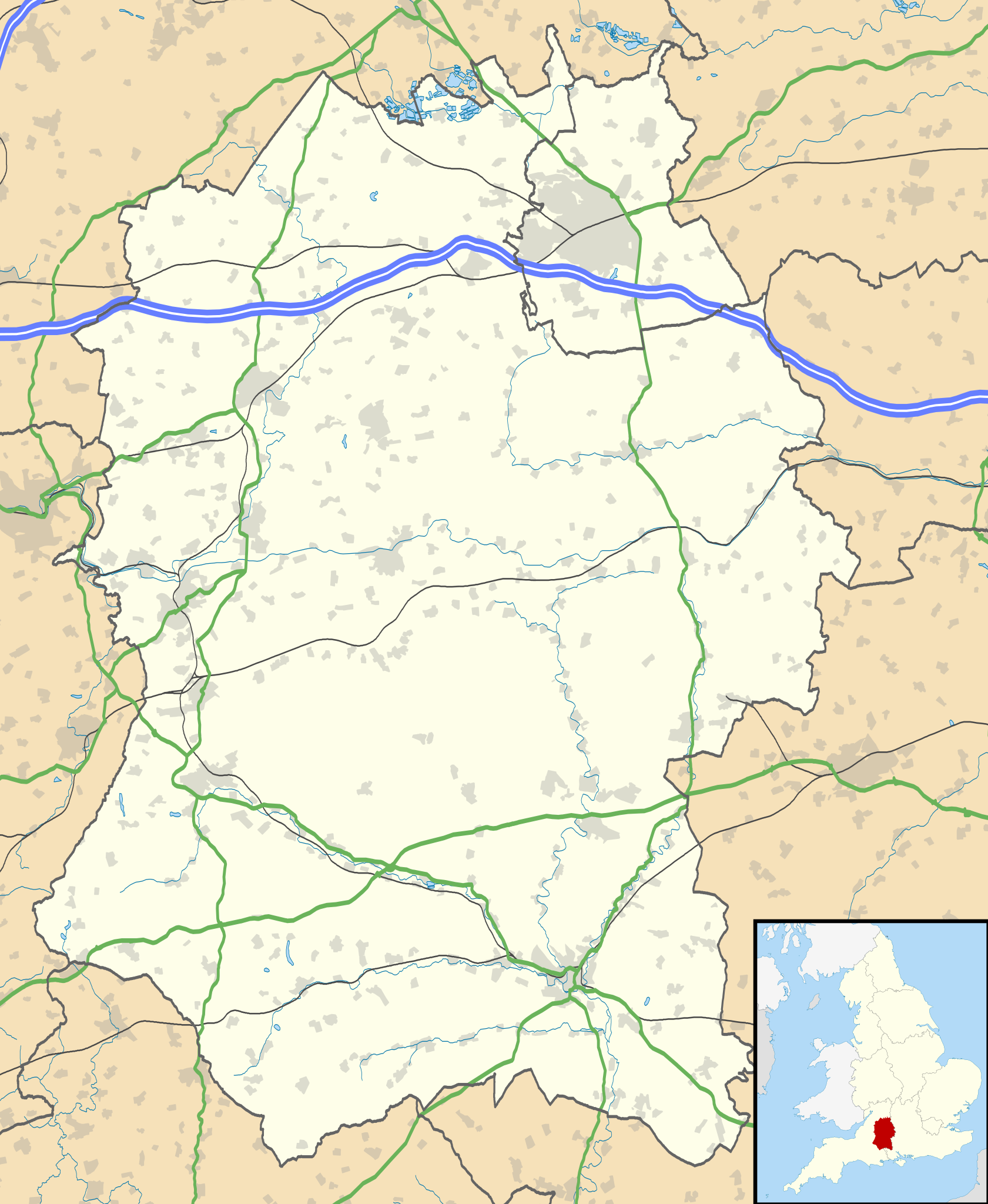
| Description | Map of Wiltshire, UK with the following information shown:
Equirectangular map projection on WGS 84 datum, with N/S stretched 160% Geographic limits:
|
| Date | |
| Source |
|
| Auteur | Nilfanion, created using Ordnance Survey data |
| Autorisation (Réutilisation de ce fichier) | Ce fichier est disponible selon les termes de la licence Creative Commons Attribution – Partage dans les Mêmes Conditions 3.0 Non Transposé. Attribution: Contains Ordnance Survey data © Crown copyright and database right
|
| Autres versions | File:Wiltshire UK district map (blank).svg - Blank map |
.svg)
Historique du fichier
Cliquer sur une date et heure pour voir le fichier tel qu'il était à ce moment-là.
| Date et heure | Vignette | Dimensions | Utilisateur | Commentaire | |
|---|---|---|---|---|---|
| actuel | 26 septembre 2010 à 19:19 | | 1 039 × 1 266 (1,76 Mio) | Nilfanion | {{Information |Description=Map of Wiltshire, UK with the following information shown: *Administrative borders *Coastline, lakes and rivers *Roads and railways *Urban areas Equirectangular map projection on WGS 84 datum, with N/S stretched |
Utilisation du fichier
Aucune page n’utilise ce fichier.
Usage global du fichier
Les autres wikis suivants utilisent ce fichier :
- Utilisation sur ar.wikipedia.org
- Utilisation sur bg.wikipedia.org
- Utilisation sur ceb.wikipedia.org
- Utilisation sur cy.wikipedia.org
- Utilisation sur da.wikipedia.org
- Utilisation sur en.wikipedia.org
- Stonehenge
- Talk:Stonehenge
- Swindon
- Salisbury
- Salisbury Cathedral
- Talk:Isambard Kingdom Brunel
- Talk:Aldhelm
- Talk:Box Tunnel
- Talk:Swindon
- Malmesbury Abbey
- Amesbury
- Lacock Abbey
- Lacock
- Talk:River Avon, Bristol
- Avebury (village)
- Odstock
- Silbury Hill
- Trowbridge
- Talk:Trowbridge
- Old Sarum
- Tiddleywink
- Talk:Robert Hallam
- Mere, Wiltshire
- Castle Hill, Mere
- Talk:Great Western Railway
- Chippenham
- Talk:Michael Ancram
- Marlborough, Wiltshire
- Talk:New Forest
- Bradford-on-Avon
- Warminster
- Brandier
- Talk:Brandier
- Devizes
- Talk:Swindon Town F.C.
- Talk:M4 motorway
- MOD Lyneham
- Pewsey
- Barbury Castle
- Wroughton
- Porton Down
- Talk:George Herbert
- Tidworth
- Edington, Wiltshire
Voir davantage sur l’utilisation globale de ce fichier.
Explore the world

United states
New York

Japan
Tokyo

Singapore
Singapore
