
 Français
 Italiano
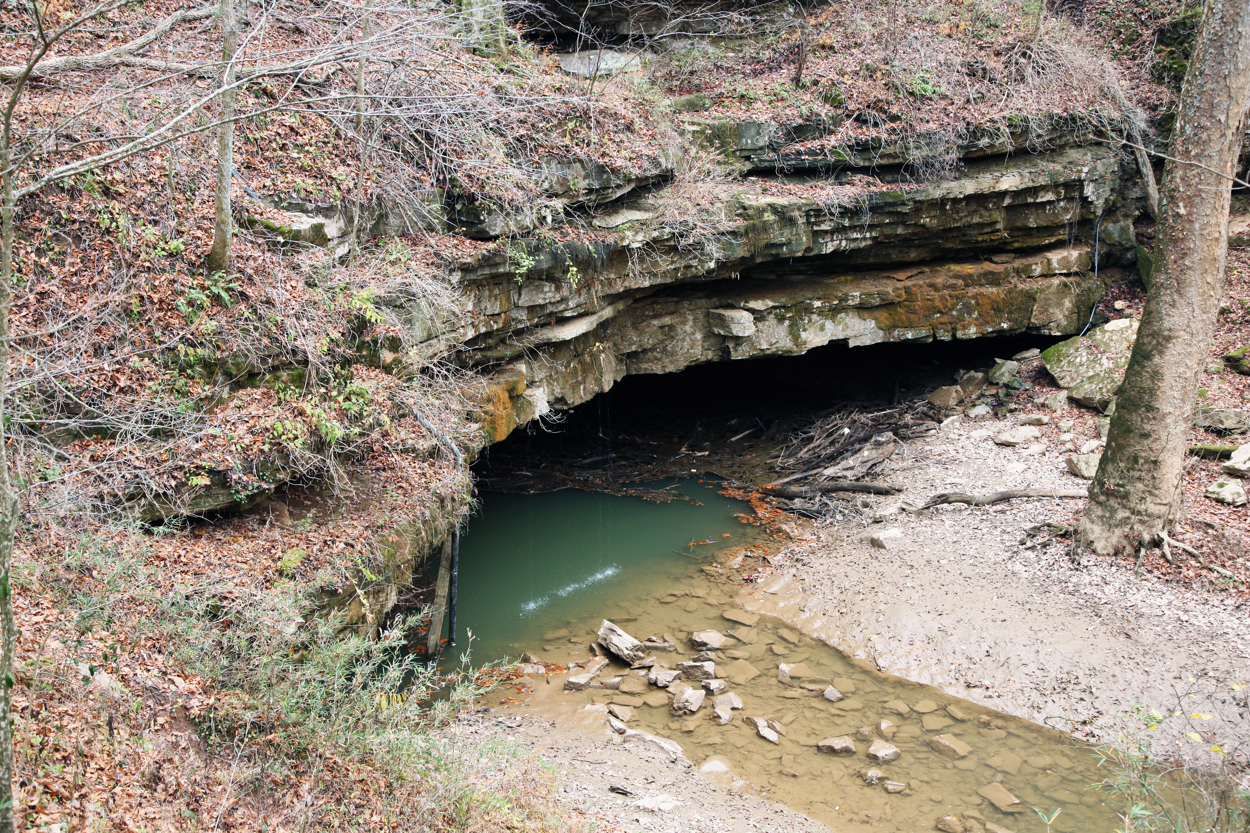
גודל התצוגה המקדימה הזאת: 800 × 533 פיקסלים. רזולוציות אחרות: 320 × 213 פיקסלים | 640 × 427 פיקסלים | 1,024 × 683 פיקסלים | 1,280 × 853 פיקסלים | 2,560 × 1,707 פיקסלים | 4,368 × 2,912 פיקסלים.
לקובץ המקורי (4,368 × 2,912 פיקסלים, גודל הקובץ: 6.67 מ"ב, סוג MIME: image/jpeg)
זהו קובץ שמקורו במיזם ויקישיתוף. תיאורו בדף תיאור הקובץ המקורי (בעברית) מוצג למטה ויקישיתוף הוא מאגר תמונות וקובצי מדיה חופשיים. אתם יכולים לעזור. |
תקציר
| תיאור | Deutsch: Der teilweise unterirdische Fluss Styx tritt im Mammoth Cave Nationalpark in Kentucky, USA, ans Tageslicht. English: River Styx, a partly subterranean waterway, emerges onto the surface in Mammoth Cave National Park. |
| תאריך יצירה | |
| מקור | נוצר על־ידי מעלה היצירה |
| יוצר | Daniel Schwen |
| גרסאות אחרות |   |
רישיון
אני, בעל זכויות היוצרים על עבודה זו, מפרסם בזאת את העבודה תחת הרישיון הבא:
הקובץ הזה מתפרסם לפי תנאי רישיון קריאייטיב קומונז ייחוס-שיתוף זהה 4.0 בין־לאומי.
- יש לך חופש:
- לשתף – להעתיק, להפיץ ולהעביר את העבודה
- לערבב בין עבודות – להתאים את העבודה
- תחת התנאים הבאים:
- ייחוס – יש לתת ייחוס הולם, לתת קישור לרישיון, ולציין אם נעשו שינויים. אפשר לעשות את זה בכל צורה סבירה, אבל לא בשום צורה שמשתמע ממנה שמעניק הרישיון תומך בך או בשימוש שלך.
- שיתוף זהה – יצירת רמיקס, שינוי או בנייה על סמך החומר הזה, תטיל עליך חובה להפיץ את התרומות שלך לפי תנאי רישיון זהה או תואם למקור.
|
|
היסטוריית הקובץ
ניתן ללחוץ על תאריך/שעה כדי לראות את הקובץ כפי שנראה באותו זמן.
| תאריך/שעה | תמונה ממוזערת | ממדים | משתמש | הערה | |
|---|---|---|---|---|---|
| נוכחית | 03:08, 26 בספטמבר 2022 | | 2,912 × 4,368 (6.67 מ"ב) | Bubba73 | Color correction, brightness |
| 20:19, 28 בנובמבר 2007 |  | 2,912 × 4,368 (9.59 מ"ב) | Dschwen | {{Information |Description={{de|Der teilweise unterirdische Fluss ''Styx'' tritt im Mammoth Cave Nationalpark in Kentucky, USA, ans Tageslicht.}} {{en|River Styx, a partly subterranean waterway, emerges onto the surface in Mammoth Cave National Park.}} |S |
שימוש בקובץ
אין דפים המשתמשים בקובץ זה.
שימוש גלובלי בקובץ
אתרי הוויקי האחרים הבאים משתמשים בקובץ הזה:
- שימוש באתר de.wikipedia.org
- שימוש באתר en.wikipedia.org
- שימוש באתר fr.wikipedia.org
- Parc national de Mammoth Cave
- Lewis and Clark National Historic Trail
- Projet:Impression/Quality images/106
- Abraham Lincoln Birthplace National Historical Park
- Big South Fork National River and Recreation Area
- Camp Nelson National Monument
- Mill Springs Battlefield National Monument
- Cumberland Gap National Historical Park
- Champ de bataille national de Fort Donelson
- Modèle:Palette Unités du National Park System au Kentucky
- Trail of Tears National Historic Trail
- שימוש באתר he.wikipedia.org
- שימוש באתר hy.wikipedia.org
- שימוש באתר id.wikipedia.org
- שימוש באתר incubator.wikimedia.org
- שימוש באתר jv.wikipedia.org
- שימוש באתר kk.wikipedia.org
- שימוש באתר mk.wikipedia.org
- שימוש באתר mt.wikipedia.org
- שימוש באתר pl.wikipedia.org
- שימוש באתר ro.wikipedia.org
- שימוש באתר ru.wikipedia.org
- שימוש באתר uk.wikipedia.org
- שימוש באתר vi.wikipedia.org
- שימוש באתר www.wikidata.org
- שימוש באתר zh.wikipedia.org
מטא־נתונים
Explore the world

United states
New York

Japan
Tokyo

Singapore
Singapore
