
 Français
 Italiano
גודל התצוגה המקדימה הזאת מסוג PNG של קובץ ה־SVG הזה: 473 × 599 פיקסלים. רזולוציות אחרות: 189 × 240 פיקסלים | 379 × 480 פיקסלים | 606 × 768 פיקסלים | 808 × 1,024 פיקסלים | 1,616 × 2,048 פיקסלים | 1,030 × 1,305 פיקסלים.
לקובץ המקורי (קובץ SVG, הגודל המקורי: 1,030 × 1,305 פיקסלים, גודל הקובץ: 1.95 מ"ב)
זהו קובץ שמקורו במיזם ויקישיתוף. תיאורו בדף תיאור הקובץ המקורי (בעברית) מוצג למטה ויקישיתוף הוא מאגר תמונות וקובצי מדיה חופשיים. אתם יכולים לעזור. |
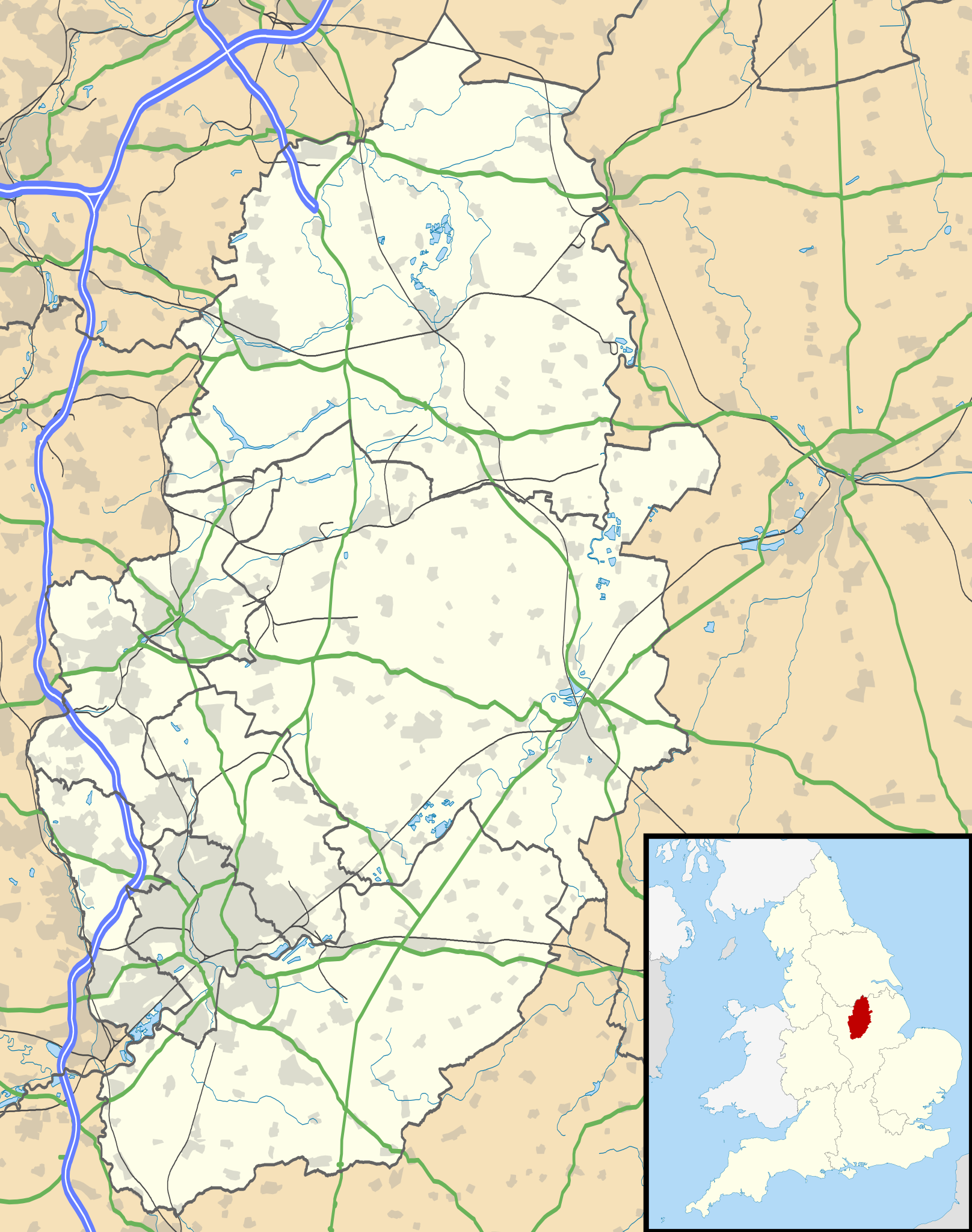
| תיאור | Map of Nottinghamshire, UK with the following information shown:
Equirectangular map projection on WGS 84 datum, with N/S stretched 165% Geographic limits:
|
| תאריך יצירה | |
| מקור |
|
| יוצר | Nilfanion, created using Ordnance Survey data |
| אישורים והיתרים (שימוש חוזר בקובץ זה) | הקובץ הזה מתפרסם לפי תנאי רישיון קריאייטיב קומונז ייחוס-שיתוף זהה 3.0 לא מותאם. ייחוס: Contains Ordnance Survey data © Crown copyright and database right
|
| גרסאות אחרות | File:Nottinghamshire UK district map (blank).svg - Blank map |
.svg)
היסטוריית הקובץ
ניתן ללחוץ על תאריך/שעה כדי לראות את הקובץ כפי שנראה באותו זמן.
| תאריך/שעה | תמונה ממוזערת | ממדים | משתמש | הערה | |
|---|---|---|---|---|---|
| נוכחית | 22:09, 26 בספטמבר 2010 | | 1,305 × 1,030 (1.95 מ"ב) | Nilfanion | {{Information |Description=Map of Nottinghamshire, UK with the following information shown: *Administrative borders *Coastline, lakes and rivers *Roads and railways *Urban areas Equirectangular map projection on WGS 84 datum, with N |
שימוש בקובץ
אין דפים המשתמשים בקובץ זה.
שימוש גלובלי בקובץ
אתרי הוויקי האחרים הבאים משתמשים בקובץ הזה:
- שימוש באתר ar.wikipedia.org
- שימוש באתר bg.wikipedia.org
- שימוש באתר br.wikipedia.org
- שימוש באתר ceb.wikipedia.org
- שימוש באתר en.wikipedia.org
- Newstead Abbey
- Beeston, Nottinghamshire
- Blyth, Nottinghamshire
- Worksop
- Newark-on-Trent
- Edwinstowe
- Nottingham Castle
- Gotham, Nottinghamshire
- Eastwood, Nottinghamshire
- Retford
- Ollerton
- Kimberley, Nottinghamshire
- The Park Estate
- Sutton Bonington
- Queen's Medical Centre
- Calverton, Nottinghamshire
- Wollaton Hall
- Newark Castle, Nottinghamshire
- Hucknall
- Arnold, Nottinghamshire
- Bircotes
- Manton, Nottinghamshire
- Scrooby
- Carlton, Nottinghamshire
- Bingham, Nottinghamshire
- West Bridgford
- Sutton-in-Ashfield
- Gamston, Rushcliffe
- Cotgrave
- RAF Syerston
- Blidworth
- Lenton, Nottingham
- Kirkby-in-Ashfield
- Tollerton, Nottinghamshire
- Rampton Secure Hospital
- Holme Pierrepont
- Zouch
- Nottingham station
- Mansfield Woodhouse
- Toton
- Redhill, Nottinghamshire
- Aslockton
- Clumber Park
- Spion Kop, Nottinghamshire
- Chilwell
צפייה בשימושים גלובליים נוספים של הקובץ הזה.
מטא־נתונים
Explore the world

United states
New York

Japan
Tokyo

Singapore
Singapore
