
 Français
 Italiano
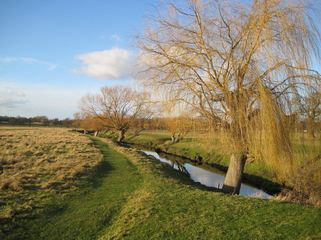
אין גרסה ברזולוציה גבוהה יותר.
Richmond_Park,_Beverley_Brook_-_geograph.org.uk_-_676367.jpg (640 × 480 פיקסלים, גודל הקובץ: 109 ק"ב, סוג MIME: image/jpeg)
זהו קובץ שמקורו במיזם ויקישיתוף. תיאורו בדף תיאור הקובץ המקורי (בעברית) מוצג למטה ויקישיתוף הוא מאגר תמונות וקובצי מדיה חופשיים. אתם יכולים לעזור. |
תקציר
| תיאור | English: Richmond Park: Beverley Brook Viewed looking downstream from the bridge carrying the road that runs through the eastern side of the park, Beverley Brook joins the River Thames near Barnes. Richmond Park, which covers almost 1,000 hectares, is designated as a National Nature Reserve (NNR), a Site of Special Scientific Interest (SSSI) and a Special Area of Conservation (SAC). |
| תאריך יצירה | |
| מקור | From geograph.org.uk |
| יוצר | Nigel Cox |
| ייחוס (required by the license) | Nigel Cox / Richmond Park: Beverley Brook / |
| מיקום המצלמה | | תמונה זו ותמונות נוספות במיקום: OpenStreetMap |
|---|
_heading:315.00&language=he)
| מיקום האובייקט | | תמונה זו ותמונות נוספות במיקום: OpenStreetMap |
|---|
_heading:315.00&language=he)
רישיון
 | This image was taken from the Geograph project collection. See this photograph's page on the Geograph website for the photographer's contact details. The copyright on this image is owned by Nigel Cox and is licensed for reuse under the Creative Commons Attribution-ShareAlike 2.0 license. |
הקובץ הזה מתפרסם לפי תנאי רישיון קריאייטיב קומונז ייחוס-שיתוף זהה 2.0 כללי.
ייחוס: Nigel Cox
- יש לך חופש:
- לשתף – להעתיק, להפיץ ולהעביר את העבודה
- לערבב בין עבודות – להתאים את העבודה
- תחת התנאים הבאים:
- ייחוס – יש לתת ייחוס הולם, לתת קישור לרישיון, ולציין אם נעשו שינויים. אפשר לעשות את זה בכל צורה סבירה, אבל לא בשום צורה שמשתמע ממנה שמעניק הרישיון תומך בך או בשימוש שלך.
- שיתוף זהה – יצירת רמיקס, שינוי או בנייה על סמך החומר הזה, תטיל עליך חובה להפיץ את התרומות שלך לפי תנאי רישיון זהה או תואם למקור.
היסטוריית הקובץ
ניתן ללחוץ על תאריך/שעה כדי לראות את הקובץ כפי שנראה באותו זמן.
| תאריך/שעה | תמונה ממוזערת | ממדים | משתמש | הערה | |
|---|---|---|---|---|---|
| נוכחית | 02:03, 8 בפברואר 2011 | | 480 × 640 (109 ק"ב) | GeographBot | == {{int:filedesc}} == {{Information |description={{en|1=Richmond Park: Beverley Brook Viewed looking downstream from the bridge carrying the road that runs through the eastern side of the park, Beverley Brook joins the River Thames near Barnes. Richmond |
שימוש בקובץ
אין דפים המשתמשים בקובץ זה.
שימוש גלובלי בקובץ
אתרי הוויקי האחרים הבאים משתמשים בקובץ הזה:
- שימוש באתר de.wikipedia.org
- שימוש באתר en.wikipedia.org
- שימוש באתר fa.wikipedia.org
- שימוש באתר hy.wikipedia.org
מטא־נתונים
Explore the world

United states
New York

Japan
Tokyo

Singapore
Singapore
