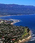
Aerial-SantaBarbaraCA10-28-08.jpg (550 × 387 פיקסלים, גודל הקובץ: 74 ק"ב, סוג MIME: image/jpeg)
היסטוריית הקובץ
ניתן ללחוץ על תאריך/שעה כדי לראות את הקובץ כפי שנראה באותו זמן.
| תאריך/שעה | תמונה ממוזערת | ממדים | משתמש | הערה | |
|---|---|---|---|---|---|
| נוכחית | 05:22, 29 בינואר 2009 |  | 387 × 550 (74 ק"ב) | Jw4nvc | == Summary == Aerial photo of Santa Barbara, California (USA) taken 1pm 10/28/08 from about 350m altitude looking toward the Northeast. In the foreground is Shoreline Park and the edge of The Mesa neighborhood. Just beyond is Ledbetter Beach and SBCC. The |
| 11:51, 2 בינואר 2009 |  | 625 × 550 (119 ק"ב) | Jw4nvc | Aerial photo of Santa Barbara, California (USA) taken 1pm 10/28/08 from about 350m altitude looking toward the Northeast. In the foreground is Shoreline Park and the edge of The Mesa neighborhood. Just beyond is Ledbetter Beach and SBCC. The harbor is nex |
שימוש בקובץ
הדפים הבאים משתמשים בקובץ הזה:
שימוש גלובלי בקובץ
אתרי הוויקי האחרים הבאים משתמשים בקובץ הזה:
- שימוש באתר af.wikipedia.org
- שימוש באתר ang.wikipedia.org
- שימוש באתר an.wikipedia.org
- שימוש באתר ar.wikipedia.org
- שימוש באתר arz.wikipedia.org
- שימוש באתר azb.wikipedia.org
- שימוש באתר az.wikipedia.org
- שימוש באתר be.wikipedia.org
- שימוש באתר ca.wikipedia.org
- שימוש באתר ceb.wikipedia.org
- שימוש באתר ce.wikipedia.org
- שימוש באתר crh.wikipedia.org
- שימוש באתר cy.wikipedia.org
- שימוש באתר dag.wikipedia.org
- שימוש באתר da.wikipedia.org
- שימוש באתר de.wikipedia.org
- שימוש באתר de.wikivoyage.org
- שימוש באתר el.wikipedia.org
- שימוש באתר en.wikipedia.org
- שימוש באתר en.wikisource.org
- שימוש באתר en.wikivoyage.org
- שימוש באתר eo.wikipedia.org
צפייה בשימושים גלובליים נוספים של הקובץ הזה.


 Français
 Italiano


