
 Français
 Italiano
Dimensioni di questa anteprima: 341 × 599 pixel. Altre risoluzioni: 136 × 240 pixel | 352 × 618 pixel.
File originale (352 × 618 pixel, dimensione del file: 33 KB, tipo MIME: image/png)
| Questo file e la sua pagina di descrizione (discussione · modifica) si trovano su Wikimedia Commons (?) |
Dettagli
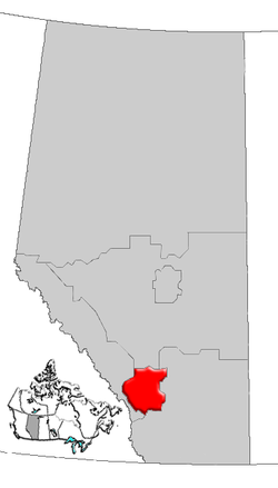
| Descrizione | Map of Calgary Region Alberta, Canada |
| Data | |
| Fonte | GIS data |
| Autore | Qyd (discussione · contributi) |
| Licenza (Riusare questo file) | All |
Licenza
| Io, detentore del copyright su quest'opera, la rilascio nel pubblico dominio. Questa norma si applica in tutto il mondo. In alcuni paesi questo potrebbe non essere legalmente possibile. In tal caso: Garantisco a chiunque il diritto di utilizzare quest'opera per qualsiasi scopo, senza alcuna condizione, a meno che tali condizioni siano richieste dalla legge. |
Cronologia del file
Fare clic su un gruppo data/ora per vedere il file come si presentava nel momento indicato.
| Data/Ora | Miniatura | Dimensioni | Utente | Commento | |
|---|---|---|---|---|---|
| attuale | 18:28, 4 gen 2007 | | 352 × 618 (33 KB) | Qyd | {{Information |Description=Map of Northern Alberta, Canada |Source=GIS data |Date=Jan 2006 |Author={{User|Qyd}} |Permission=All |other_versions= }} Category:Maps of Alberta |
Utilizzo del file
La seguente pagina usa questo file:
Utilizzo globale del file
Anche i seguenti wiki usano questo file:
- Usato nelle seguenti pagine di de.wikipedia.org:
- Usato nelle seguenti pagine di en.wikipedia.org:
- Aldersyde, Alberta
- Priddis Greens
- Sheep River (Alberta)
- Benchlands
- Stoney 142, 143, 144
- Kathyrn
- Keoma, Alberta
- Madden, Alberta
- Glenbow, Alberta
- Bottrel
- Cochrane Lake, Alberta
- Conrich
- Elbow Valley, Alberta
- Dalemead
- Dalroy
- Delacour, Alberta
- Indus, Alberta
- Janet, Alberta
- Confederation Park, Calgary
- Heritage Pointe
- Hartell, Alberta
- Chestermere Lake
- Carseland
- Foothills Nordic Ski Club
- Cowboys Park
- Sikome Lake
- Cedarbrae, Calgary
- Template:CalgaryRegion-geo-stub
- Castleridge, Calgary
- Centennial Place (Calgary)
- Blackie, Alberta
- Ghost Lake
- Ghost Lake, Alberta
- Waiparous
- Priddis, Alberta
- Redwood Meadows
- Ralph Klein Park
- Millarville
- User:Volker.haas/PositionAbsolute
- Artists View Park West, Alberta
- Heritage Woods, Alberta
- High Point Estates, Alberta
- Azure, Alberta
- Bennett, Alberta
- List of historic places in the Calgary Region
- Vortex (Calaway Park)
- West Village, Calgary
- Big Hill (Alberta)
- Stoney 142B
Visualizza l'utilizzo globale di questo file.
Explore the world

United states
New York

Japan
Tokyo

Singapore
Singapore
