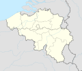
Afmetingen van deze voorvertoning van het type PNG van dit SVG-bestand: 689 × 599 pixels Andere resoluties: 276 × 240 pixels | 552 × 480 pixels | 883 × 768 pixels | 1.177 × 1.024 pixels | 2.355 × 2.048 pixels | 1.136 × 988 pixels.
Oorspronkelijk bestand (SVG-bestand, nominaal 1.136 × 988 pixels, bestandsgrootte: 142 kB)
Bestandsgeschiedenis
Klik op een datum/tijd om het bestand te zien zoals het destijds was.
| Datum/tijd | Miniatuur | Afmetingen | Gebruiker | Opmerking | |
|---|---|---|---|---|---|
| huidige versie | 5 jan 2025 19:55 |  | 1.136 × 988 (142 kB) | NordNordWest | upd 2025 |
| 27 dec 2021 23:11 |  | 1.136 × 988 (142 kB) | NordNordWest | == {{int:filedesc}} == {{Information |description= {{de|1=Positionskarte von Belgien}} {{en|1=Location map of Belgium}} {{Location map series N |stretching=157,218 |top=51.8 |bottom=49.2 |left=2.2 |right=6.9 }} |source={{Own using}} * United States National Imagery and Mapping Agency data * World Data Base II data |date=2021-12-27 |author={{U|NordNordWest}} |other fields= }} {{Kartenwerkstatt}} == {{int:license-header}} == {{User:NordNordWest/LicenceMap}} [[Category:Location maps of Europe... |
Bestandsgebruik
Geen enkele pagina gebruikt dit bestand.
Globaal bestandsgebruik
Dit bestand wordt op de volgende andere wiki’s gebruikt:
- Gebruikt op af.wikipedia.org
- Gebruikt op als.wikipedia.org
- Gebruikt op an.wikipedia.org
- Gebruikt op ar.wikipedia.org
- Gebruikt op arz.wikipedia.org
- Gebruikt op ast.wikipedia.org
Globaal gebruik van dit bestand bekijken.


 Français
 Italiano


