
 Français
 Italiano
Bu SVG dosyasının PNG önizlemesinin boyutu: 541 × 541 piksel. Diğer çözünürlükler: 240 × 240 piksel | 480 × 480 piksel | 768 × 768 piksel | 1.024 × 1.024 piksel | 2.048 × 2.048 piksel.
Orijinal dosya (SVG dosyası, sözde 541 × 541 piksel, dosya boyutu: 63 KB)
.svg)
Özet
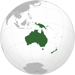
| Açıklama | English: Orthographic map of Oceania. |
| Tarih | |
| Kaynak | Own work based on: Australia (orthographic projection).svg |
| Yazar | Ch1902 |
| SVG gelişimi | Bu SVG kaynak kodu geçerlidir. Bu vektörel grafik Inkscape ile oluşturuldu. SVG watermarked with invisible embedded text. |
.svg)
Lisanslama
Ben, bu işin telif sahibi, burada işi aşağıdaki lisanslar altında yayımlıyorum:
Bu dosya, Creative Commons Atıf-Benzer Paylaşım 3.0 Taşınmamış lisansı ile lisanslanmıştır
- Şu seçeneklerde özgürsünüz:
- paylaşım – eser paylaşımı, dağıtımı ve iletimi
- içeriği değiştirip uyarlama – eser adaptasyonu
- Aşağıdaki koşullar geçerli olacaktır:
- atıf – Esere yazar veya lisans sahibi tarafından belirtilen (ancak sizi ya da eseri kullanımınızı desteklediklerini ileri sürmeyecek bir) şekilde atıfta bulunmalısınız.
- benzer paylaşım – Maddeyi yeniden düzenler, dönüştürür veya inşa ederseniz, katkılarınızı özgünüyle aynı veya uyumlu lisans altında dağıtmanız gerekir.
 | Bu belgenin GNU Özgür Belgeleme Lisansı, Sürüm 1.2 veya Özgür Yazılım Vakfı tarafından yayımlanan sonraki herhangi bir sürüm şartları altında bu belgenin kopyalanması, dağıtılması ve/veya değiştirilmesi için izin verilmiştir; Değişmeyen Bölümler, Ön Kapak Metinleri ve Arka Kapak Metinleri yoktur. Lisansın bir kopyası GNU Özgür Belgeleme Lisansı sayfasında yer almaktadır. |
İstediğiniz lisansı seçebilirsiniz.
Dosya geçmişi
Dosyanın herhangi bir zamandaki hâli için ilgili tarih/saat kısmına tıklayın.
.svg&dir=prev)
.svg&offset=20221204003112)
.svg&offset=&limit=20)
.svg&offset=&limit=50)
.svg&offset=&limit=100)
.svg&offset=&limit=250)
.svg&offset=&limit=500)
| Tarih/Saat | Küçük resim | Boyutlar | Kullanıcı | Yorum | |
|---|---|---|---|---|---|
| güncel | 18.54, 6 Şubat 2023 | | 541 × 541 (63 KB) | Golden Mage | A change to the map of Asia will first face debate from others. Hence, a change to the commonly accepted map of Oceania cannot be made without a wider consensus. |
| 06.33, 6 Şubat 2023 |  | 541 × 541 (108 KB) | Kwamikagami | rv: then perhaps we need to change the Asia map to match. This is as defined in WP. | |
| 18.19, 5 Şubat 2023 |  | 541 × 541 (63 KB) | Golden Mage | Reverted to the map that displays the more accepted definition of Oceania's boundaries. Widely accepted geopolitical definitions take precedence over mere geographical ones. The map of the Wikipedia page for Asia already includes the Maluku Islands. | |
| 05.01, 5 Şubat 2023 |  | 541 × 541 (108 KB) | Treetoes023 | Reverted to version as of 06:27, 24 December 2022 (UTC) | |
| 05.00, 5 Şubat 2023 |  | 541 × 541 (63 KB) | Treetoes023 | Reverted to version as of 13:25, 31 December 2022 (UTC) | |
| 04.55, 5 Şubat 2023 |  | 541 × 541 (108 KB) | Treetoes023 | Reverted to version as of 00:31, 4 December 2022 (UTC) | |
| 13.25, 31 Aralık 2022 |  | 541 × 541 (63 KB) | Golden Mage | Reverted to the map that displays the more accepted definition of Oceania's boundaries. Widely accepted geopolitical definitions take precedence over mere geographical ones. | |
| 06.27, 24 Aralık 2022 |  | 541 × 541 (108 KB) | Kwamikagami | Reverted to version as of 00:31, 4 December 2022 (UTC) definition per WP-en | |
| 06.13, 22 Aralık 2022 |  | 541 × 541 (63 KB) | Golden Mage | Reverted to the map that displays the more accepted definition of Oceania's boundaries. | |
| 00.31, 4 Aralık 2022 |  | 541 × 541 (108 KB) | Kwamikagami | the Weber line divides Oceanic from Asian Wallacea |
Dosya kullanımı
Aşağıdaki sayfa bu dosyayı kullanmaktadır:
Küresel dosya kullanımı
Aşağıdaki diğer vikiler bu dosyayı kullanır:
- ab.wikipedia.org üzerinde kullanımı
- ady.wikipedia.org üzerinde kullanımı
- af.wikipedia.org üzerinde kullanımı
- Afrika
- Asië
- Europa
- Kiribati
- Noord-Amerika
- Suid-Amerika
- Vanuatu
- Guam
- Nieu-Seeland
- Sjabloon:Kontinente
- Australië
- Nauru
- Wellington, Nieu-Seeland
- Hoofstad
- Lys van hoofstede
- Sjabloon:Lande van Oseanië
- Honolulu
- Antarktika
- Gondwana
- Eurasië
- Laurasië
- Kategorie:Lande in Oseanië
- Lys van lande
- Fidji
- Canberra
- Hawaii
- Lys van nasionale leuses
- Clipperton
- Oseanië
- Norfolkeiland
- Amerikas
- Tonga
- Tuvalu
- Sjabloon:Hoofstede in Oseanië
- Palau
- Australië (kontinent)
- Afrika-Eurasië
- Samoa
- Marshalleilande
- Salomonseilande
- Papoea-Nieu-Guinee
- Gefedereerde State van Mikronesië
- Nukuʻalofa
- Port Moresby
- Apia
- Funafuti
- Honiara
- Majuro
Bu dosyanın daha fazla küresel kullanımını görüntüle.
.svg)
Üstveri
.svg)
Explore the world

United states
New York

Japan
Tokyo

Singapore
Singapore
