Size of this preview: 570 × 600 pixels. Other resolutions: 228 × 240 pixels | 456 × 480 pixels | 730 × 768 pixels | 973 × 1,024 pixels | 1,330 × 1,399 pixels.
Original file (1,330 × 1,399 pixels, file size: 374 KB, MIME type: image/png)
File history
Click on a date/time to view the file as it appeared at that time.
| Date/Time | Thumbnail | Dimensions | User | Comment | |
|---|---|---|---|---|---|
| current | 23:57, 9 October 2022 |  | 1,330 × 1,399 (374 KB) | SelfieCity | per voy:Wikivoyage:Travellers' pub |
| 10:34, 1 July 2022 |  | 1,330 × 1,386 (938 KB) | SHB2000 | Extend/Add Victorian border | |
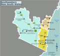
| 05:08, 1 July 2022 |  | 1,460 × 1,366 (922 KB) | SHB2000 | {{Information |Description=A static map of Southeastern New South Wales for use on Wikivoyage. |Source={{own}} |Date=2022-07-01 |Author=SHB2000 |Permission= |other_versions=SVG file }} Category:Wikivoyage maps Category:Maps of New South Wales |
File usage
The following 2 pages use this file:


 Français
 Italiano


