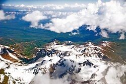
Natural monuments of Tajikistan
Lists of natural monuments are compiled for the Wiki Loves Earth contest
 | Location: Area: 2,611,674 ha On the map: 1 Links: Description: IUCN category II (National Park). World Heritage Site. |
 | Karakul Location: Gorno-Badakhshan Autonomous Region, Murghob District Area: 380 km² On the map: 1 Links: Description: Ramsar site. |
 | Muzkul Sanctuary Location: Gorno-Badakhshan Autonomous Region, Murghob District Area: 669.16 km² On the map: 1 Links: Description: IUCN category IV (Habitat/Species Management Area). |
Districts under Central Government Jurisdiction
[править] | Almosy Sanctuary Location: Districts under Central Government Jurisdiction Area: 60 km² On the map: 2 Links: Description: IUCN category IV (Habitat/Species Management Area). |
 | Kamarov Sanctuary Location: Districts under Central Government Jurisdiction, Rasht District Area: 90 km² On the map: 3 Links: Description: IUCN category IV (Habitat/Species Management Area). |
 | Ramit State Nature Reserve Location: Districts under Central Government Jurisdiction, Vahdat District Area: 161.62 km² On the map: 1 Links: Description: IUCN category Ia (Strict Nature Reserve). |
 | Sangvor Sanctuary Location: Districts under Central Government Jurisdiction, Sangvor District Area: 509 km² On the map: 4 Links: Description: IUCN category IV (Habitat/Species Management Area). |
 | Shirkent National Park Location: Districts under Central Government Jurisdiction, Tursunzoda District Area: 319 km² On the map: 2 Links: Description: IUCN category II (National Park). |
Gorno-Badakhshan Autonomous Region
[править] | Rangkul valley Location: Gorno-Badakhshan Autonomous Region, Murghob District Area: 2,400 ha On the map: 2 Links: Description: Ramsar site. |
 | Location: Gorno-Badakhshan Autonomous Region, Murghob District Area: 877 km² On the map: 2 Links: Description: IUCN category Ia (Strict Nature Reserve). Tentative World Heritage Site. |
 | Zorkul Location: Badakhshan Province, Wakhan Area: 38.9 km² On the map: 3 Links: Description: Ramsar site. |
Khatlon Province
[править] | Childukhtaron Sanctuary Location: Khatlon Province, Muminobod District Area: 145 km² On the map: 5 Links: Description: IUCN category IV (Habitat/Species Management Area). |
 | Dashti-Jum Nature Reserve Location: Khatlon Province, Shamsiddin Shohin District Area: 197 km² On the map: 3 Links: Description: IUCN category Ia (Strict Nature Reserve). Tentative World Heritage Site. |
 | Dashtijum Sanctuary Location: Khatlon Province, Shamsiddin Shohin District Area: 501 km² On the map: 6 Links: Description: IUCN category IV (Habitat/Species Management Area). |
 | Norak Sanctuary Location: Khatlon Province, Norak Area: 300 km² On the map: 7 Links: Description: IUCN category IV (Habitat/Species Management Area). |
 | Qaratogh Sanctuary Location: Khatlon Province, Farkhor District Area: 144 km² On the map: 8 Links: Description: IUCN category IV (Habitat/Species Management Area). |
 | Sari-Khosor Nature Park Location: Khatlon Province, Baljuvon District Area: 3.09 km² On the map: 3 Links: Description: IUCN category IV (Habitat/Species Management Area). |
 | Location: Khatlon Province, Dusti District Area: 497.86 km² On the map: 4 Links: Description: IUCN category Ia (Strict Nature Reserve). World Heritage Site. |
 | Lower part of Pyandj River Location: Khatlon Province, Dusti District On the map: 4 Links: Description: Ramsar site. |
Sughd Province
[править] | Iskandarkul Sanctuary Location: Sughd Province, Ayni District Area: 300 km² On the map: 9 Links: Description: IUCN category IV (Habitat/Species Management Area). |
 | Kayrakkum Reservoir Location: Sughd Province Area: 520 km² On the map: 5 Links: Description: Ramsar site. |
 | Kusavlisoy Sanctuary Location: Sughd Province, Shahriston District Area: 198.44 km² On the map: 10 Links: Description: IUCN category IV (Habitat/Species Management Area). Tentative World Heritage Site. |
 | Oqtosh Sanctuary Location: Sughd Province, Asht District Area: 150 km² On the map: 11 Links: Description: IUCN category IV (Habitat/Species Management Area). |
 | Sayvota Sanctuary Location: Sughd Province, Ayni District Area: 42 km² On the map: 12 Links: Description: IUCN category IV (Habitat/Species Management Area). |
 | Yaghnob National Nature Park Location: Sughd Province, Ayni District Links: Description: national park. |
 | Zaravshon Sanctuary Location: Sughd Province, Panjakent District Area: 23 km² On the map: 13 Links: Description: IUCN category IV (Habitat/Species Management Area). |


 Français
 Italiano


